We independently review everything we recommend. When you buy through our links, we may earn a commission. Any support is appreciated.
Quick Look into Top 5
The ultimate all-in-one powerhouse – GPSMAP 67i
Tiny, ultralight, essential satellite safety – inReach Mini 3
Infinite battery via the sun – eTrex Solar
Best reception for the money – GPSMAP 65s
Super Minimalistic – inReach Messenger Plus
Finding the right one for yourself may be difficult due to the large industry providing a lot of trackers. We have narrowed down the 12 best GPS trackers for hiking as of 2026 to get you started.
First: Terms and Features
Altimeter/barometer

Though all GPS trackers come with an altitude reading based on the satellite data, a tracker that comes with an altimeter and barometer would produce far more accurate elevation readings when you are in the woods or mountains.
Preloaded maps
These are maps that are provided on the GPS when you purchase them, which are base maps. Most devices also accept separately purchased topography maps that are either downloaded or provided on a SD card. You can then manage all the maps you have by simply connecting your device to a computer or laptop.
Communication
With some GPS trackers come a unit-to-unit call feature which allows you to communicate with friends and hikers nearby and also see the location of where they are.
This would be really useful when hiking with a group of friends in the woods without phone connections, a great touch that comes with GPS operated navigations.
Compass type

GPS devices usually come with either a differential compass or an electric compass, both of these are helpful in general but if you are looking to locate your bearings then an electronic compass is a more suitable option.
With one of those, without any movements or whatsoever you will be able to check your bearings which is pretty important for some but not so for others, it is really up to you and your preference.
GPS memory storage
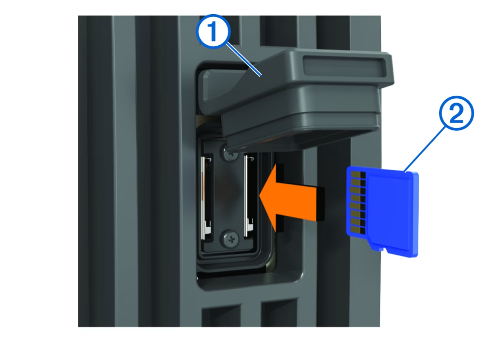
Finding a GPS with an external memory storage may be a good choice as you will be able to add more storage area. With more storage area available as opposed to a fixed one you can save more data into your GPS tracker along with more topography maps, points of interest and also updates.
Durability
Looking for a GPS tracker that looks complex and fancy may be one’s choice but the tracker itself should be able to perform its functions. The tracker should be able to withstand pressure and also be water resistant if not waterproof. Choosing a GPS that can withstand your conditions and not break so easily should be the priority, a GPS that has a good body strength and resistance to harsh conditions is what you go for.
Battery
Also to be considered is the battery life of the GPS, going for a hike would sometimes take long hours or even days for some so looking for a tracker that is able to last is important.
Usually, these GPS trackers come with two power options, those with batteries which you change from time to time or those that you would have to charge when the battery is low.
Both of them have their own advantages and it is up to you to decide, if changing batteries from time to time when out hiking is alright for you then it shouldn’t be a problem.
A tip is that you always reduce the backlight of the device to conserve the battery as much as possible, use lithium batteries as they last longer and is durable and always bring spare batteries on your trips just in case.
Miscellaneous

You should consider the smaller features that come with the trackers, the size of it, the weight, quality of the screen and also the number of maps that are available.
Carrying a lighter and smaller tracker would be easy to use and handled but may not be such for some who prefer larger ones with larger screens.
It is therefore important that you read through the specs the cameras offer when buying as you would never actually know what you want and what you need.
Our Top 12 GPS Trackers for 2026 (not in order)
1. Garmin inReach Explorer+

The Garmin inReach Explorer+ is a legacy powerhouse that defined the modern era of backcountry safety, offering a robust blend of standalone GPS mapping and 100% global Iridium satellite communication. While newer, slimmer models have since hit the market, the Explorer+ remains a favorite for its “tank-like” build and reliable physical buttons that don’t fail when your fingers are frozen or the screen is covered in mud. The internal lithium battery is remarkably efficient for a mapping unit, providing roughly 100 hours of tracking in standard mode, which is more than enough for a heavy week of movement without a recharge. It’s a dedicated safety tool first, featuring a prominent SOS button and the ability to receive detailed weather forecasts directly to the device, ensuring you aren’t walking blindly into a storm system.
Despite its legendary status, the Explorer+ is starting to show its age when compared to the lightning-fast processors of the newer GPSMAP series. The screen resolution is noticeably lower than current flagship models, and the map rendering can feel sluggish when you’re trying to pan across complex topography.
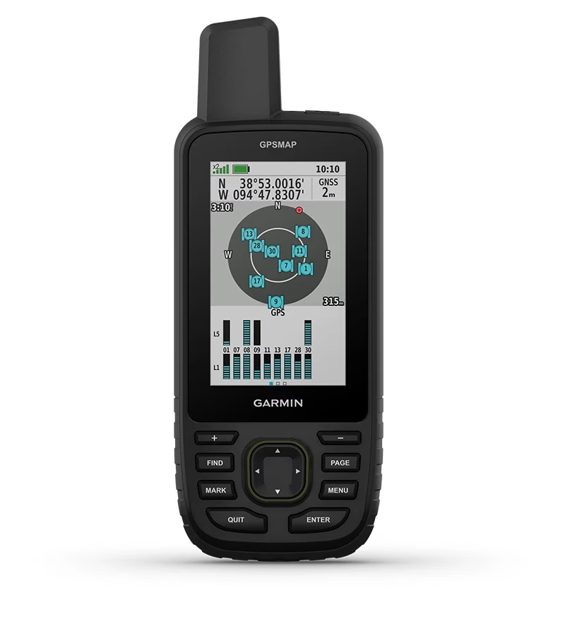
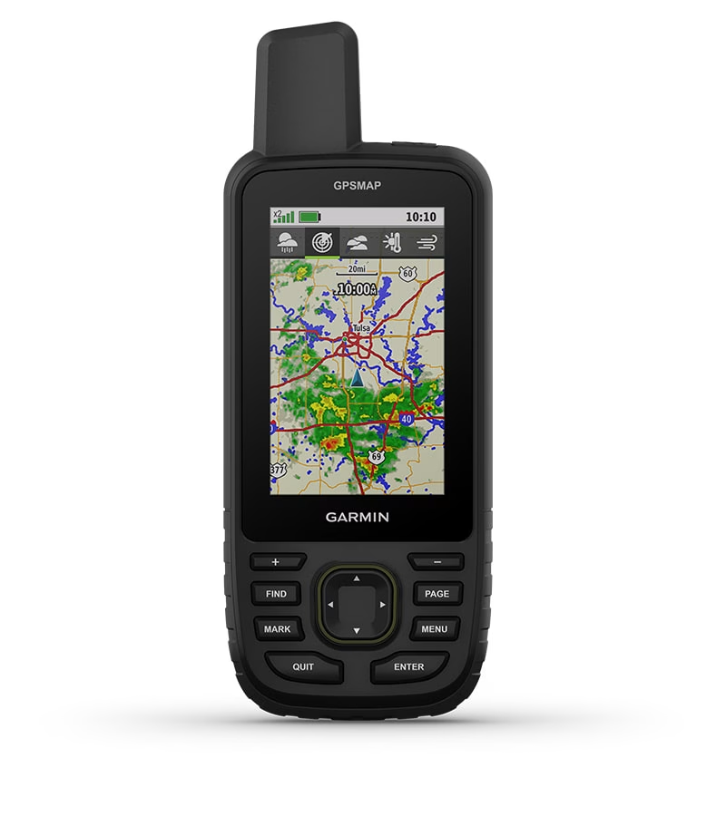
2. Garmin GPSMAP 67i
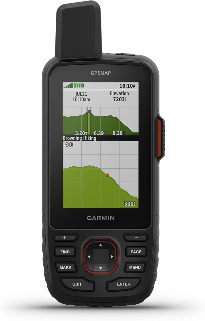
The GPSMAP 67i is arguably the most capable handheld ever built, merging high-end navigation with the peace of mind of inReach satellite technology. The standout feature is the shift to a massive 180-hour internal lithium battery, which solves the power-drain issues that plagued previous generations. This unit pulls a pinpoint signal in thick timber where older models often bounce, thanks to its multi-band GNSS support. It’s a premium investment, but for those who need two-way messaging and top-tier mapping in one rugged chassis, it’s the undisputed king of the mountain.
While the 67i is a powerhouse, it’s certainly not for the minimalist. The unit is bulky, and the button-heavy interface has a learning curve that might frustrate those used to the swipe-and-tap ease of a smartphone. It also requires a recurring subscription to access the satellite features, which adds a “hidden” monthly cost to an already expensive device. However, unlike touch-based models that fail in the rain or with gloves, the 67i is built for the worst possible conditions. If you prioritize reliability and communication above all else, the weight and cost are easily justified.
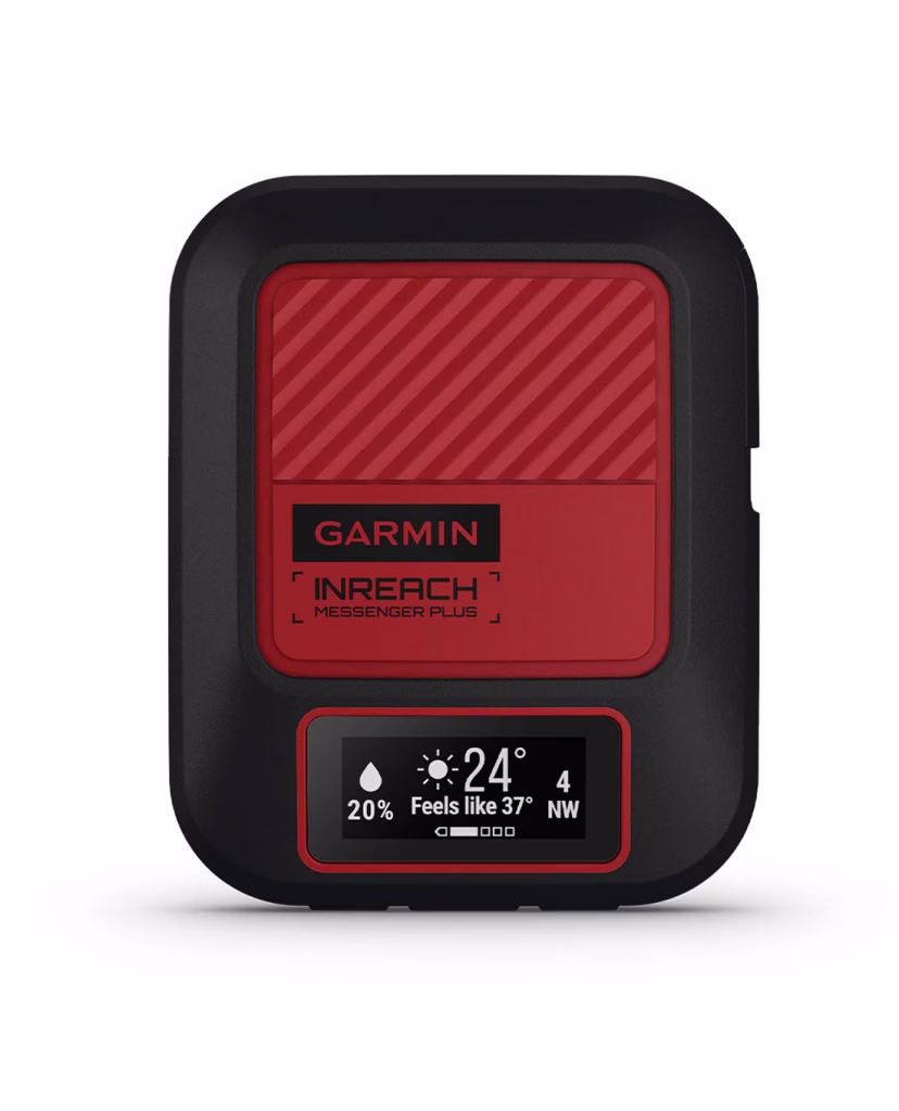
3. Garmin inReach Messenger Plus
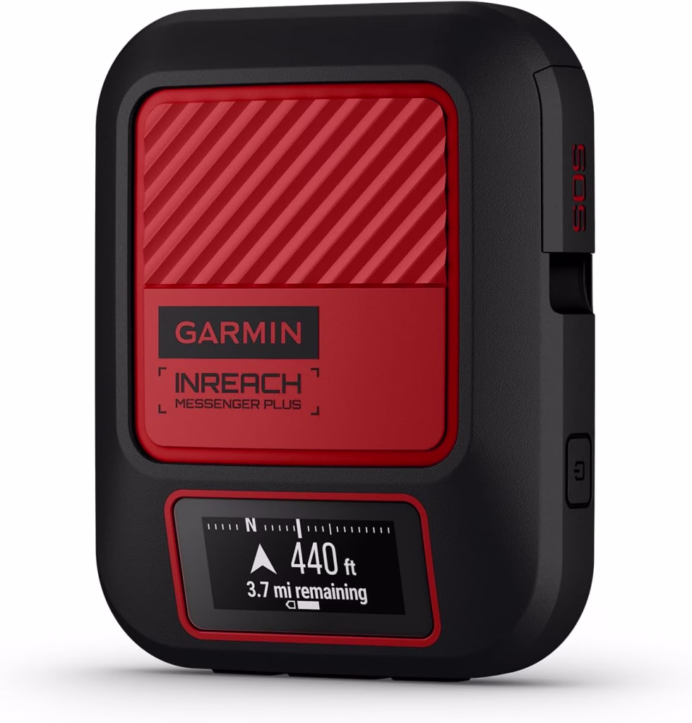
If your primary goal is staying connected without the bulk of a full-sized GPS, the Messenger Plus is a focused, high-performance alternative. This pocket-sized unit focuses heavily on communication, now supporting photo and voice messaging over the Iridium network. It’s designed to live on your pack strap, acting as a bridge for your smartphone via the Garmin Messenger app. The “Reverse Charging” capability—allowing you to give your dead phone a quick boost—makes it an essential safety tool for long-distance hikers who rely on phone-based navigation apps like Gaia or AllTrails.
The trade-off here is the screen. The on-device display is tiny and strictly for basic notifications and “breadcrumb” navigation; you won’t be scrolling through detailed topographic maps here. This means you are essentially tethered to your smartphone for any real visual route planning. If your phone dies and you haven’t used the reverse-charge feature in time, you’re left with a very expensive SOS button. That said, for the hiker who already loves their phone’s mapping interface but needs a bulletproof satellite link, the Messenger Plus is the most streamlined solution available.
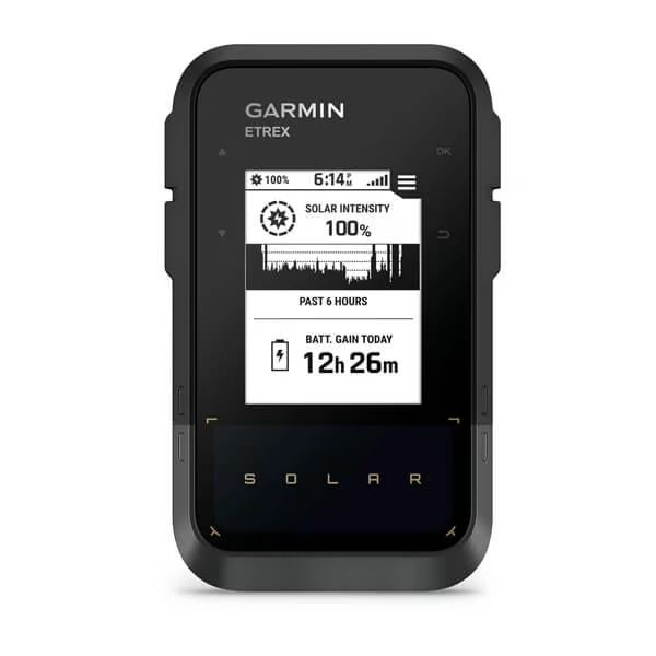
4. Garmin eTrex Solar
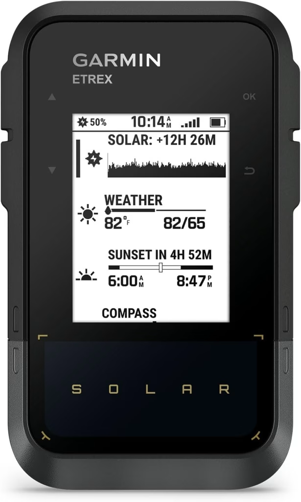
The eTrex Solar represents a massive leap in efficiency, offering virtually “infinite” battery life when exposed to consistent sunlight. It’s a streamlined, high-contrast digital compass that does away with heavy color maps to focus on pure reliability. For thru-hikers covering high-mileage days in open terrain, this is a “set it and forget it” device. It provides highly accurate track logging and simple navigation, ensuring you can always find your way back to the trailhead without ever reaching for a charging cable or a spare set of AAs.
However, the lack of mapping is a significant hurdle for complex off-trail navigation. You’re looking at a monochromatic screen with a simple line to follow, which can feel primitive compared to the rich detail found on the GPSMAP series. It also lacks the advanced sensors like a barometric altimeter found in higher-end models, meaning your elevation data won’t be quite as precise. But if your mission involves long weeks in the sun and you want to delete “battery anxiety” from your vocabulary, the eTrex Solar is a specialized tool that does exactly what it promises.
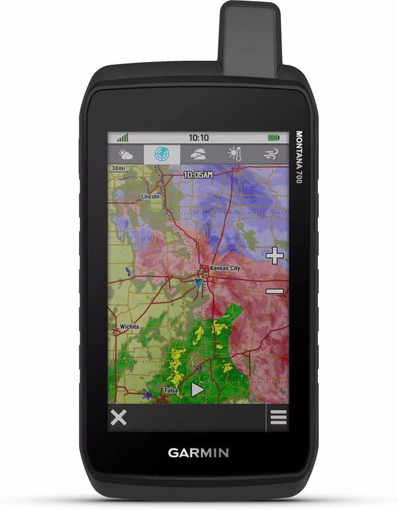
5. Garmin Montana 710
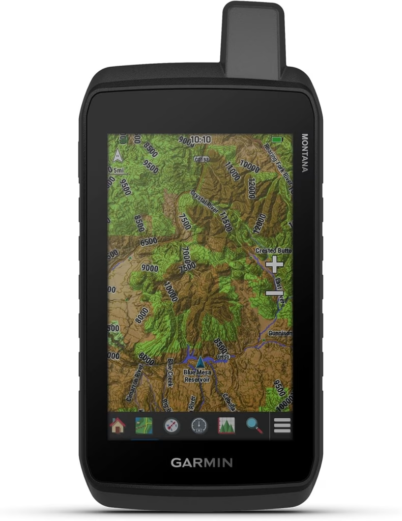
For those who want a “dashboard” experience in the palm of their hand, the Montana 710 offers a massive 5-inch, glove-friendly touchscreen that feels more like a ruggedized tablet than a standard GPS. The updated hardware handles TopoActive maps with zero lag, and the inclusion of a USB-C charging port finally brings the series into the modern era. It’s a versatile beast that excels in high-detail environments, making it a favorite for those who need to see large sections of a trail at once without constantly zooming and panning.
The downside is the sheer footprint of the device. At nearly 14 ounces, it’s a brick in your pocket and can feel like overkill for a standard day hike. The large screen is also a notorious battery hog; even with the improved power management, you’ll be charging this much more frequently than a button-operated eTrex. It’s the model for the “power user” who doesn’t mind the weight penalty in exchange for the best visual experience in the woods, but ultralight backpackers will likely find it too cumbersome for high-mileage treks.
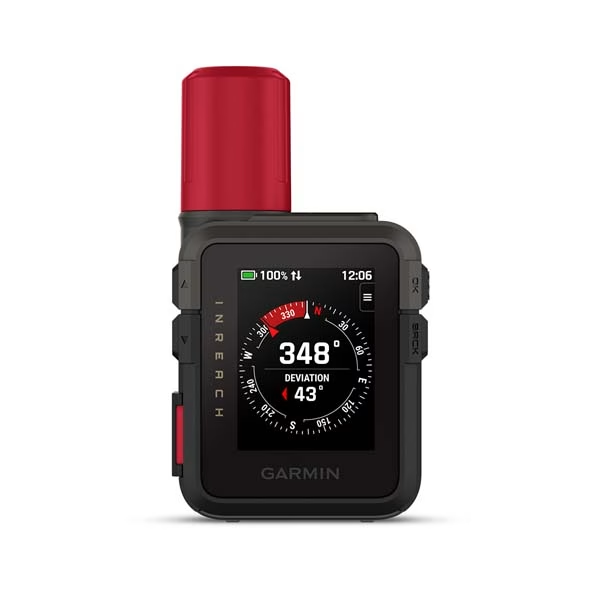
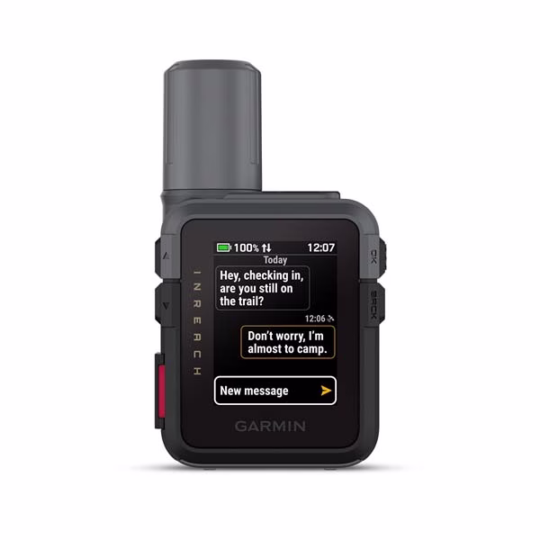
6. Garmin inReach Mini 3
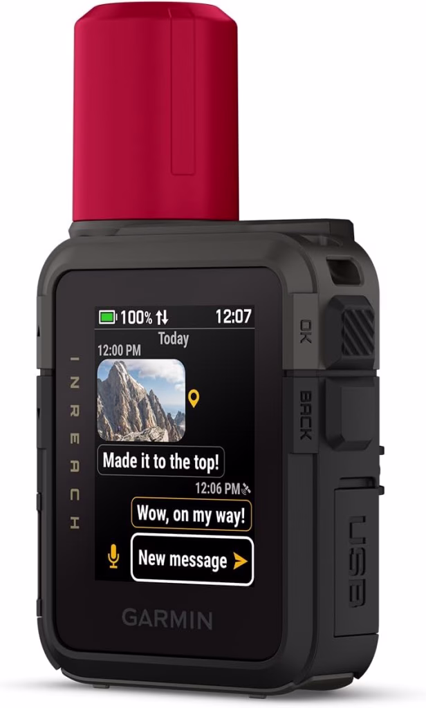
The Mini 3 remains the favorite for the “fast and light” crowd, weighing in at a measly 3.5 ounces. It’s a dedicated satellite communicator first and a navigator second. The updated display offers much better legibility in direct glare, and the revamped user interface makes sending quick “check-in” texts significantly faster. It’s the perfect insurance policy for solo hikers who want an SOS button that doesn’t weigh them down, disappearing onto a pack shoulder strap until it’s needed.
The compromise is, again, the lack of on-board mapping. Navigating via the Mini 3 alone is a utilitarian experience—you’re following a pointer and a distance-to-waypoint counter. Like the Messenger Plus, it really shines when paired with a phone, but it lacks the phone-charging capabilities of its larger siblings. While it’s the most popular satellite tool on the trail, those who want a standalone map to verify their position at a glance will find the Mini 3 frustratingly limited.
7. Garmin Foretrex 801
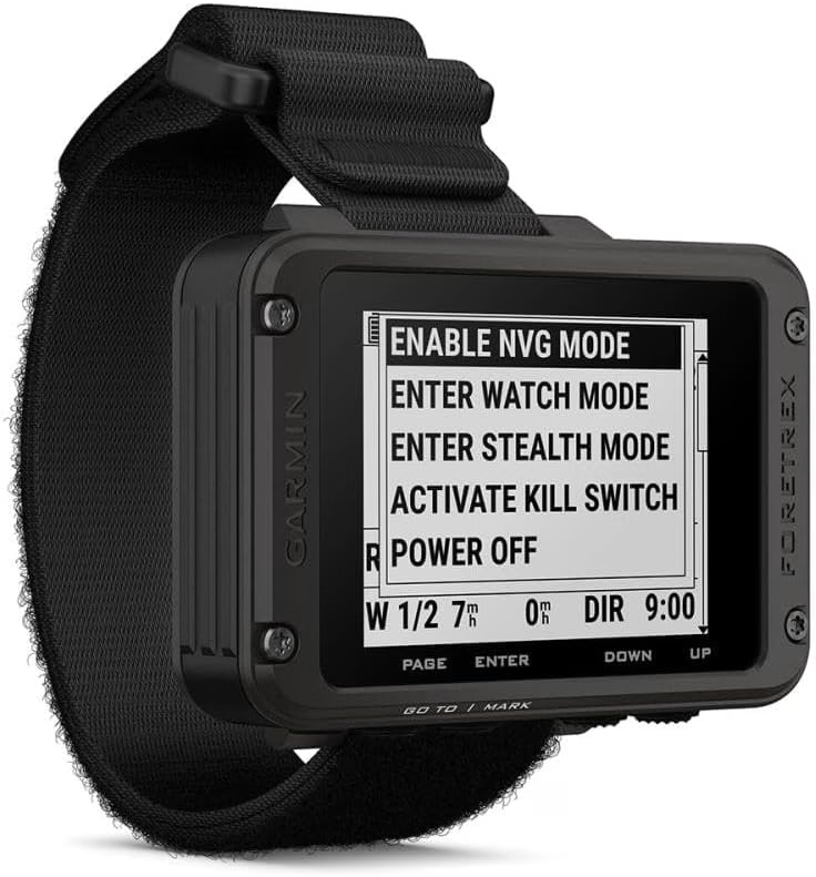
The Foretrex 801 is the go-to for scramblers and hikers who prefer to keep their hands on their trekking poles. This wrist-mounted unit is built to military standards and prioritizes simplicity and durability. It runs on AAA batteries—which can last over 1,000 hours in expedition mode—and provides a clear, monochromatic read on your headings and coordinates. It’s a no-nonsense tool for those who need to check their position at a glance without fumbling through pockets or packs.
While the hands-free aspect is brilliant, the 801 is strictly for data-driven navigation. There are no maps, no color, and no fancy lifestyle widgets. The screen is small, and if you have poor eyesight, reading the tiny coordinate strings while moving can be a challenge. It’s a very specific tool for a specific type of user—someone who treats their hike like a mission and values “up-time” and durability over a pretty interface. It’s a reliable backup to a paper map, but it won’t replace the visual ease of a handheld mapping unit.
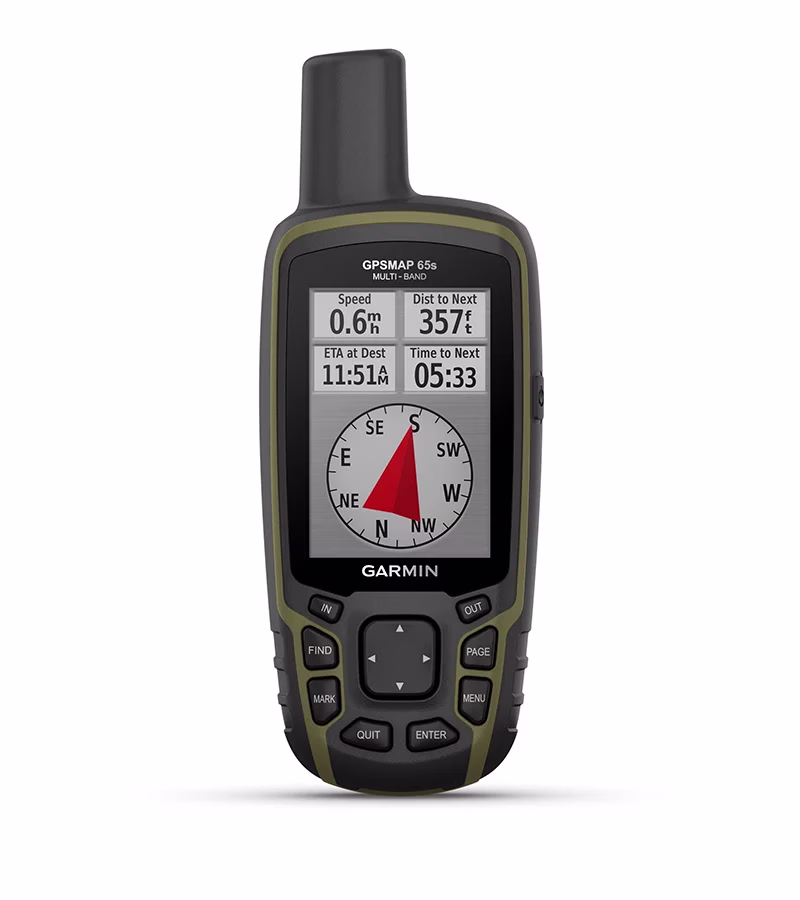
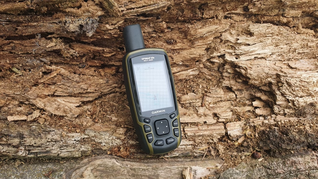
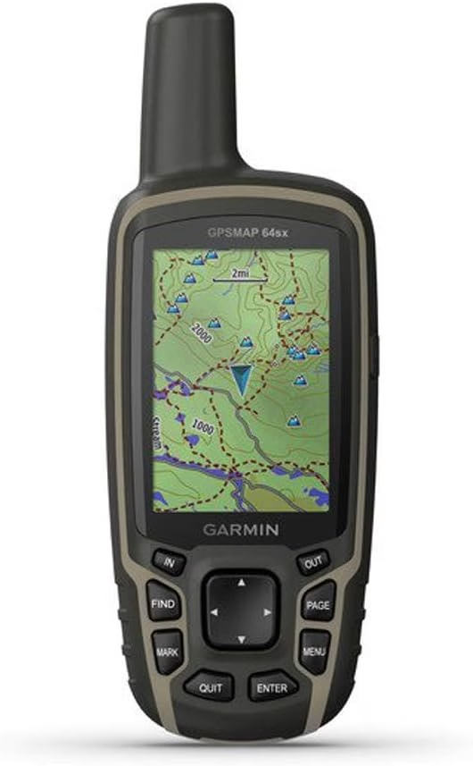
8. Garmin GPSMAP 65s
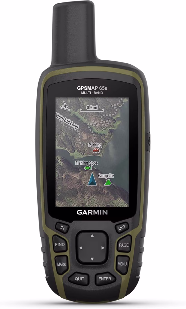
The 65s is the “value” pick for serious navigators who don’t need the extra cost of a satellite subscription. It utilizes a Quad-Helix antenna, which is widely considered the gold standard for satellite reception in challenging environments. By stripping away the inReach messaging, Garmin has delivered a professional-grade mapping tool at a much more accessible price point. It’s fast, incredibly accurate, and uses AA batteries, making it a reliable workhorse for remote expeditions where charging isn’t an option.
The main drawback is that you lose the “safety net” of satellite communication. In an emergency, the 65s can tell you exactly where you are, but it can’t tell anyone else. It also feels a bit dated compared to the sleek internal-battery models, and the 2.6-inch screen can feel cramped when you’re trying to navigate dense, multi-trail junctions. However, if you already carry a separate satellite messenger, or if you simply want the most accurate GPS receiver Garmin makes without the subscription bloat, the 65s is a remarkably solid choice.
9. Garmin eTrex 32x
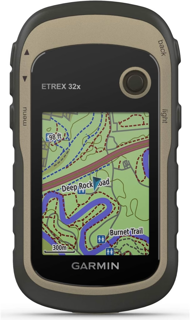
A perennial favorite in the hiking community, the eTrex 32x is a compact, button-operated unit that balances portability with a full-color mapping experience. It comes preloaded with TopoActive maps and features an 8GB internal memory for adding your own custom charts. While the 2.2-inch screen is small, it remains perfectly readable in the sun. It’s an excellent entry-level choice for hikers who want a dedicated map on their belt without spending a fortune.
On the other hand, the 32x can feel sluggish when loading large map files or zooming out quickly. The processor just isn’t as snappy as the GPSMAP series, which can lead to “map lag” when you’re moving fast. It also lacks the multi-band GNSS of the newer units, meaning its accuracy might drift a few meters in heavy tree cover or near cliffs. It’s a great “standard” GPS, but if you’ve used the high-end models, the 32x will feel like a step back in terms of performance speed.
10. Garmin eTrex SE
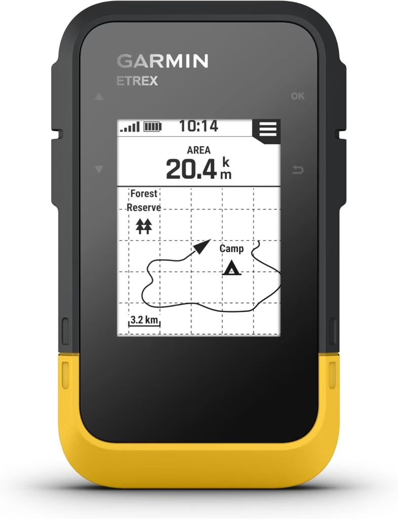
The eTrex SE is the modern evolution of the classic budget GPS, featuring a high-resolution 2.2-inch monochrome display that draws very little power. It connects via Bluetooth to the Garmin Explore app, allowing you to sync routes and weather updates directly from your phone. It’s a minimalist’s dream—rugged, water-resistant to IPX7, and capable of running for weeks on a pair of AA batteries in its power-save mode. It’s the perfect “backup” device to keep in the bottom of your pack.
The “SE” moniker essentially stands for “Simplified,” and that’s exactly what you get. There is no mapping, no color, and no internal memory for custom data. It is a digital compass and breadcrumb tracker, period. If you’re looking for a primary navigation tool to lead you through a complex mountain range, this isn’t it. But for the weekend hiker who wants a reliable way to get back to the car if they get turned around, the SE provides modern connectivity at an entry-level price point.
11. Garmin Montana 700
The Oregon 700 hits the sweet spot between the tiny eTrex and the oversized Montana. It features a 3-inch multi-touch display and a redesigned antenna for better reception than older touch models. It’s particularly popular with geocachers due to its seamless integration with Geocaching.com and its ergonomic, rounded shape that fits perfectly in the hand. It offers a much more “modern” feel than the button-operated GPSMAP series while staying small enough for a pocket.
However, the touchscreen remains a love-it-or-hate-it feature. In the rain, the screen can become finicky, and cold weather can sap the battery life much faster than button-based units. While the interface is intuitive, the Oregon doesn’t offer the same “bombproof” feeling as the 67i or the 64sx. It’s a fantastic device for casual day hikers and geocachers who want an easy-to-use interface, but it might not be the first choice for a rugged, multi-week expedition into the wilderness.
12. Garmin GPSMAP 64sx
For those who hike in harsh winter conditions where touchscreens are a liability, the 64sx is the “tank” of the lineup. Its large, tactile buttons are easy to operate with heavy gloves, and its rugged construction has a legendary reputation for surviving drops on granite. It’s a “pro-sumer” device that focuses on pure function, offering reliable GPS and GLONASS tracking in a package that has been field-tested by thousands of professionals over the years.
The trade-off here is the tech. The 64sx is an older design; it’s heavier, the screen resolution is lower, and it lacks the advanced multi-band satellite support found in the 67 series. It’s also significantly slower to sync with your phone and lacks the internal rechargeable battery convenience of modern units. That said, there is a reason these are still everywhere: they are nearly impossible to break. If you care more about a device that will turn on every single time regardless of the temperature or terrain, the 64sx is the old-school king.
How they Work and why you need them

A GPS by itself means Global Positioning System, it is a satellite-based radionavigation system which provides time information and geolocation too.
Garmin GPS trackers work by connecting to multiple global navigation satellite systems (GNSS), including GPS, GLONASS, and Galileo, to provide precise location data. These devices continuously receive signals from satellites, calculating exact positions in real-time.
Advanced models come with built-in sensors like barometric altimeters, accelerometers, and compasses to improve accuracy, even in challenging environments like dense forests or mountainous terrain. Some units also offer LTE connectivity or satellite communication, ensuring you stay connected even in areas without cellular service.
Having a GPS tracker is essential for anyone who values safety, navigation, or asset protection. Outdoor adventurers can rely on these to navigate unfamiliar trails, mark waypoints, and send emergency SOS signals if needed.
You need one of these because it helps you preplan the routes you want to take and trace the route to return back safely. It also allows you to mark potential camp areas, ranger stations or make contact with colleagues who are nearby too.
Conclusion

All the mentioned GPS trackers above come with their very own specialities and features. Choosing the right one for you may not be that hard in this instance as the brand itself, Garmin is rest assured a great GPS company.
The guidelines stated would be a great help for you when going through the top 7 that we have stated so far.
Obviously, these trackers don’t come with all the features you would want in one, all of them come in different shapes and sizes, choosing the ideal one would take time and some thought.
The entire article you’ve read so far comes with all the essentials you need to know and the best you can find in the market by Garmin, it is now your choice, choose wisely and consider all the key features you are looking for. Good Luck!
Also, come read our recent article, 10 Best Action Cameras to Invest In 2026: Full Guide and Review which would be a good addition for your hiking trips too.
Till next time.